
Trace a University Park Street
Address research in University Park works best as a chain, not a roster. Dallas Central Appraisal District, known as DCAD, is the starting point for a property address. Its card supplies the account number, situs, owner label, tax mailing address, legal description, map link, exemptions, and history tabs. The recorded-document index then tests a transfer against the legal description. Historic directories and voter procedures provide separate, limited clues rather than a complete household list.
- Enter the address in DCAD and open the blue property-address result. Save the 17-character account number, exact situs address, owner label, and legal description.
- Use the DCAD map to inspect parcels along the same University Park street. An adjoining polygon is a parcel relationship, not evidence about a person or household.
- Search the legal description, instrument number, or named grantor and grantee in the Dallas County Clerk Official Public Records index. Read the deed as a transaction record.
- For a registration question, use the individual Texas voter route with a VUID, a supplied driver-license number, or first and last name. It is not a street-browse tool.
- For a dated address clue, compare the Dallas Cross Reference and Park Cities directory volumes, then check the date, street label, and supporting deed or map.
A street directory can connect these records, but the connection needs care. A match on an address may identify a parcel, a mailing contact, a recording party, or a historic listing. Those are different facts.
University Park Street Directory Fields
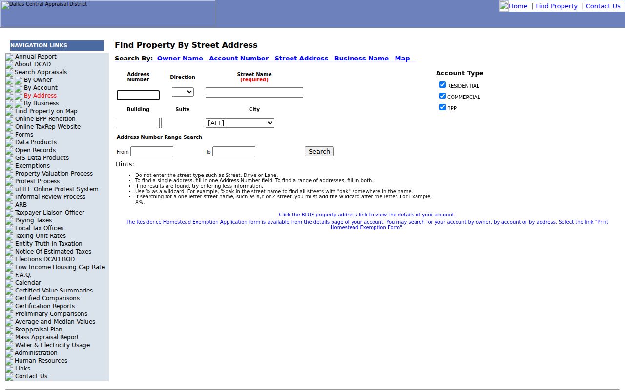
The DCAD address search is built for an address or a range, not a full street-name list without a number. Number accepts numbers only and can be a single address or a From/To range. Street Name needs at least two characters, no spaces, and permits a percent-sign wildcard. Direction, Building, Suite, City, and Account Type help narrow a result when the street has close matches.
| DCAD field | Use on a street search | Format or limit |
|---|---|---|
| Number | One property or a From/To range | Numbers only |
| Direction | Separate a directional street variant | Optional dropdown |
| Street Name | Street stem for the address match | At least two characters, no spaces, % wildcard |
| Building and Suite | Refine a multi-unit result | Both optional |
| City and Account Type | Limit the result set | Optional; Residential, Commercial, or BPP account type |
The official interface makes the field rules visible before the search. That is useful when a normal-looking street phrase returns nothing because the portal expects the number separately or suppresses spaces in the street-name field.
The DCAD address-search screen shows the address controls used to narrow a street-address search.
After a result opens, the parcel card carries the identifiers that make later deed and map checks more reliable than a street name alone.
Map a University Park Street
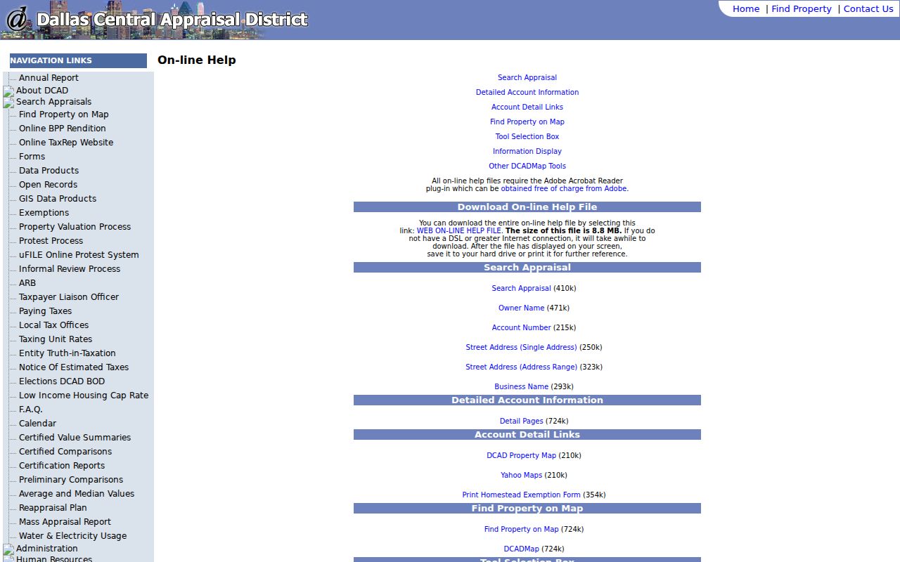
DCAD is also the parcel-map source identified by Dallas County GIS. Its help page documents Zoom In, Zoom Out, Pan, Identify, Parcel Identify, Measure, Clear Selection, layers, a legend, print, and other map controls. Search or pan to a known parcel, select it, then use Identify or Parcel Identify on adjacent shapes. Open the linked property address for each parcel instead of treating the map label as the whole record.
The Measure control can describe distance or a map relationship, but it is not a survey. Likewise, a map neighbor is an adjoining parcel, not necessarily a nearby household. Layers can change with the live map configuration, so confirm an active layer before relying on it for a boundary or district question.
The DCAD map help documents the parcel-viewer tools available for a University Park street search.
Moving from the selected polygon to its parcel card preserves the account number and legal-description trail needed for a recorded-document search.
Read University Park Parcel Addresses
Three address-like fields need separate treatment. The situs is the property location displayed on the DCAD card. The owner mailing address is where tax correspondence goes. The legal description identifies the lot, block, subdivision, abstract, or other land description used in recorded documents. A mailing address can be in another city or state, and neither mailing nor situs proves who is physically present at a property.
- Parcel
- A defined piece of land represented by a DCAD account and a mapped shape.
- Situs address
- The physical property location on the appraisal card, distinct from the owner mailing address.
- Plat
- A recorded map that can show a subdivision, lot, block, and boundaries used to bridge descriptions.
- Criss-cross directory
- An address-to-name directory arranged to help locate a historical listing at a street number.
DCAD owner search can supplement an address search when the parcel card gives a name. It recommends Last Name First Name, at least two first-name letters, and a percent-sign wildcard. Try both McDonald and Mc Donald where relevant. Multiple accounts can match one owner label, so the physical address remains the check against a same-name error.
Follow University Park Street Deeds
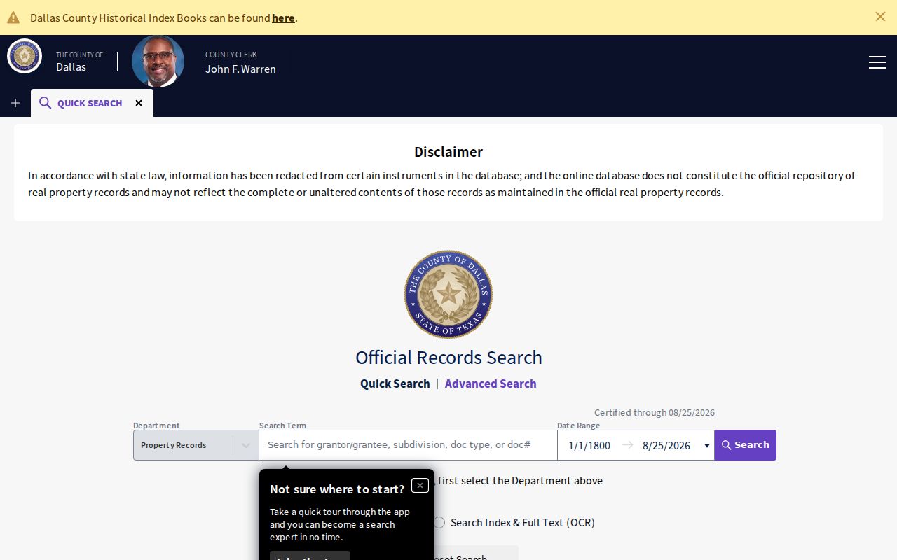
The Dallas County Clerk Official Public Records search is the official index for recorded instruments. Quick Search and Advanced Search support grantor, grantee, recorded date, legal-description, document-type, instrument-number, book, and page routes. Select Index Only when the indexed terms are enough, or use Index and Full Text OCR when an image's text may supply the phrase. The portal is a free, non-certified starting point.
Start with the instrument number or legal description from the parcel card where one is shown. Locate the conveyance, identify its grantor and grantee, then search the prior grantor as an earlier grantee while keeping the lot, block, or subdivision in view. Postal labels can shift, but the instrument and legal description can bridge a street-number change. The research did not establish an oldest online index year, so use the clerk's counter or document request route for an older record.
The Dallas County deed index provides the grantor, grantee, date, instrument, and legal-description paths used to verify a transfer.
When a copy is needed, the Recording Division is at 500 Elm Street, Suite 2100, Dallas, Texas 75202, telephone 214-653-7099, Monday through Friday, 8:00 a.m. to 4:30 p.m. Plain copies cost $1 per page or document; certification adds $5 per document. Its request form also provides a mail or counter fallback.
University Park Street Permit Clues
University Park Building Permits supplies a different kind of address history. The city links a monthly permit activity report through its WebLink repository and directs building questions to Community Development at 214-987-5411. New construction, demolition, system additions, inspections, plan review, and final inspection can place a physical change in time.
A permit generally expires after 60 days if inspections do not begin. That is an administrative rule, not a move-in date. For files not available through the current activity report, request a defined address and date range through the city under the Texas Public Information Act. The University Park Library's Brown Books add subdivision records of individual construction permits across several decades, although the exact series and years need confirmation with library staff.
Permit records may name an applicant or contractor in a particular document. They do not establish ownership, transfer title, or prove present occupancy.
University Park Street Postal Labels
University Park, Park Cities, Highland Park, Dallas, SMU, and subdivision names can all appear around the same local address trail. Official University Park facilities use Dallas postal labels with 75205 or 75225, even where the civic address identifies University Park. A modern Dallas postal label is therefore not evidence that a parcel sits outside University Park.
For an older listing, search the label used in that volume and compare cross streets, lot and block, map, and OPR instrument. No verified University Park street-renumbering or renaming year was located. The sound method is to preserve the historical label rather than invent a conversion year.
University Park Street Directory Records
Each address-keyed source answers a narrower question. DCAD shows an appraisal account and owner-related fields; the map shows parcels; the Clerk index records transactions; city permits document construction activity. None turns a University Park street directory into a current list of everyone at each address.
| Address record | Local keeper | What it supports | How to reach it |
|---|---|---|---|
| DCAD account card | Dallas Central Appraisal District | Account, situs, owner, mailing address, legal description, exemptions, and history | Free owner, address, account, business, or map search |
| Parcel map | DCAD map with county GIS coordination | Parcel shape, adjoining parcels, map layers, and link to card | Free viewer with Identify and Parcel Identify |
| Recorded instrument | Dallas County Clerk Recording Division | Grantor, grantee, recorded date, instrument, and legal description | Free index; counter or mail copies available |
| Permit activity | University Park Community Development | Address-specific construction and inspection chronology | Monthly report, permit materials, or defined PIA request |
| Historic cross-reference | Dallas Public Library | Date-specific address-to-listing clues | Library holdings and reading resources |
The account number is the practical connector from the DCAD card to the parcel. The legal description and instrument number are stronger connectors to a deed than the street name. City, postal, and historical directory labels should be saved as separate fields, not blended into one conclusion.
University Park Street Directory History
Dallas Public Library's address-oriented shelf provides a historical route that current parcel tools do not. Dallas Cross Reference no. 193 includes runs for 1936, 1940, 1944-45, and 1951-2019 with gaps. Park Cities Telephone Directory no. 549 includes 1970, 1981, and 1988-2010 ranges, while Park Cities Highland Park/University Park no. 779 is dated 1997. A historic entry can show a listing and address for that edition, not a present fact.
Check the volume's abbreviation key, street index, and cross-reference instructions before matching a number. Unlisted telephone subscribers may not appear. A dated directory listing gains value when the same year aligns with a deed, permit, newspaper item, or map, but each source still has its own scope.
University Park's 1924 incorporation and its connection to SMU explain why the local record trail can cross Dallas, Park Cities, Highland Park, and University Park labels. Use the label that belonged to the record's period, then reconcile it with the parcel's legal description.
University Park Street Voter Limits
The individual Texas voter lookup uses a VUID, a driver-license number supplied during registration, or first and last name. It does not provide a street-wide public browse. A Chapter 18 voter-file request is a different procedure: Form 24-1 can request selected counties and can produce address and ZIP fields, subject to delivery terms, fees, and the required use affidavit.
Protected and suppressed records are excluded or limited. Texas confidentiality routes can replace an address with protected treatment, and the individual portal is not a substitute for a formal file request. A voter match also does not establish every person at an address.
Limits of a University Park Street Directory
No public property roll, motor-vehicle address list, utility customer roll, or complete household list establishes everyone connected with an address. A deed records a legal transaction. A tax mailing address receives correspondence. A historic directory records a period listing. The correct use is to distinguish those facts, confirm important records with the custodian, and avoid publishing protected details.